Author
Zigurat Global Institute of Technology
Blog / BIM & Construction Management
Categories
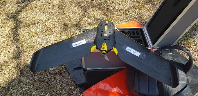 Step 2: the drone is configured through the application that accompanies it in order to capture the terrain (flight plan).
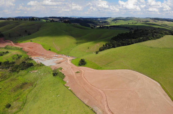
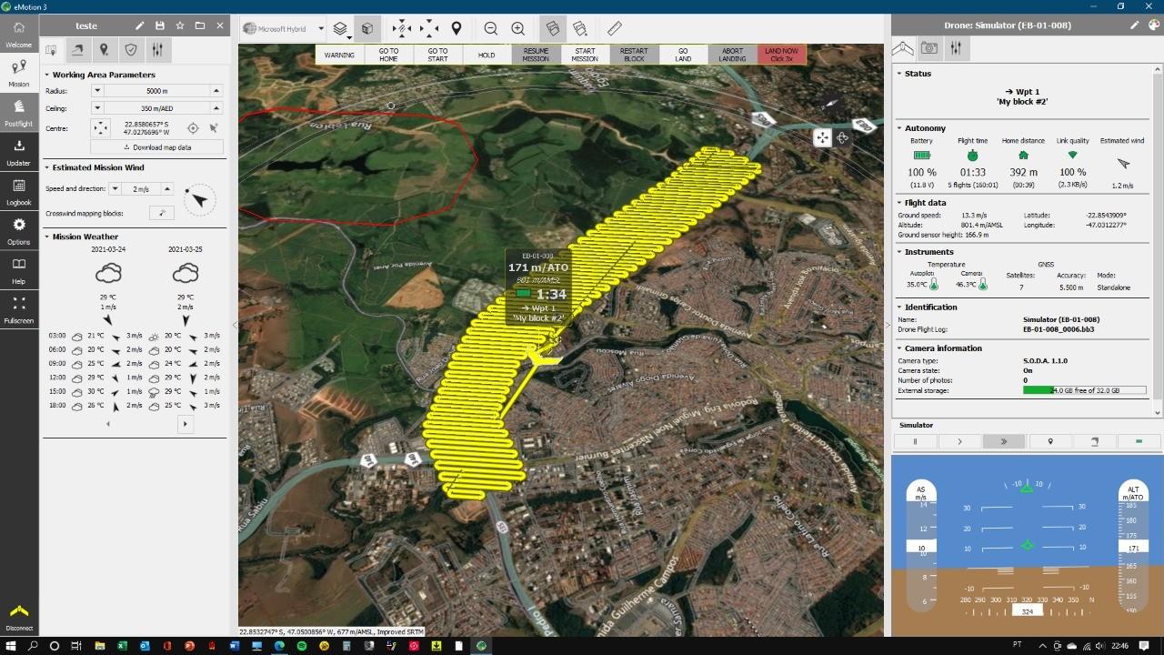 Step 3: the flight is done and the photographs are captured
Step 4: These images are transferred to a computer
Step 5: With a specific software, these files are transformed into a mesh file or point cloud, where it is possible to manipulate, edit and better configure this data. The type of data will depend on the purpose of use.
Step 3: the flight is done and the photographs are captured
Step 4: These images are transferred to a computer
Step 5: With a specific software, these files are transformed into a mesh file or point cloud, where it is possible to manipulate, edit and better configure this data. The type of data will depend on the purpose of use.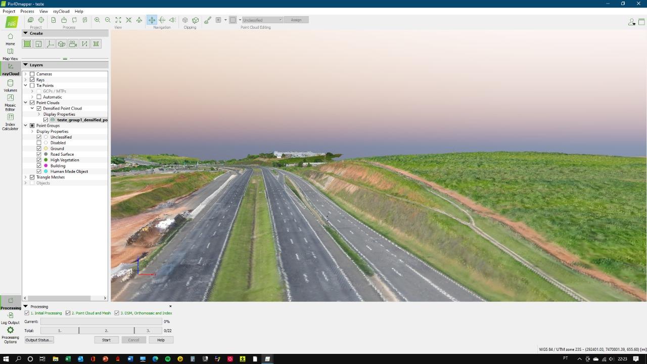 Step 6: This file is imported into the highway modeling software, where it is possible to use it for the preparation of the basic study or project.
It is worth mentioning that these types of files resulting from photogrammetry are large, requiring good computers to perform this task, so, there is a significant investment for the adoption of such technology.
The idea here is not to promote one methodology over the other, as each case is different, and it may happen that a combination of technologies may be necessary to supply such demand. Because, sometimes not everything can be captured with a certain technology, so there is the need of a complementation from another technology.
Regardless of the chosen technology, the more accurate the region is mapped, the better the quality of the project because the result will be: a more economical, assertive project, with better productivity and less risk of rework. Technology is our allied force!
Image credits: Concessionária Rota das Bandeiras e Fernando Pellegrino Martin
Author: Solange Gaspar, Project Engineer | BIM | Road Infrastructure | Innovation. Alumni of the Zigurat's Master Internacional em BIM Management para Infraestruturas, Engenharia Civil e GIS.
Step 6: This file is imported into the highway modeling software, where it is possible to use it for the preparation of the basic study or project.
It is worth mentioning that these types of files resulting from photogrammetry are large, requiring good computers to perform this task, so, there is a significant investment for the adoption of such technology.
The idea here is not to promote one methodology over the other, as each case is different, and it may happen that a combination of technologies may be necessary to supply such demand. Because, sometimes not everything can be captured with a certain technology, so there is the need of a complementation from another technology.
Regardless of the chosen technology, the more accurate the region is mapped, the better the quality of the project because the result will be: a more economical, assertive project, with better productivity and less risk of rework. Technology is our allied force!
Image credits: Concessionária Rota das Bandeiras e Fernando Pellegrino Martin
Author: Solange Gaspar, Project Engineer | BIM | Road Infrastructure | Innovation. Alumni of the Zigurat's Master Internacional em BIM Management para Infraestruturas, Engenharia Civil e GIS.

Zigurat Global Institute of Technology