Blog / BIM & Construction Management
7 Benefits of a Civil Engineering Degree in BIM and GIS
Categories
In the rapidly evolving field of civil engineering, the integration of Building Information Modeling (BIM) and Geographic Information Systems (GIS) has revolutionised the way infrastructure projects are designed, managed, and executed.
A master's degree in civil engineering with a focus on these cutting-edge technologies offers numerous benefits, from enhanced project visualisation to improved sustainability.
This article explores seven key benefits of pursuing a civil engineering degree with a specialisation in these technologies, providing real-world examples to illustrate their impact.
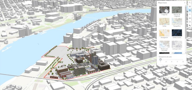
1. Enhanced Project Visualisation
What It Is: BIM and GIS offer advanced tools for creating detailed visual representations of infrastructure projects.
Why It Is Important: Visualising projects in 3D helps engineers, stakeholders, and clients understand the scope and design more intuitively, reducing misunderstandings and miscommunications.
Applications:
- Planning urban infrastructure with realistic models.
- Simulating construction sequences to foresee potential issues.
- Presenting projects to clients and the public with greater clarity.
Real-World Example: The Sydney Opera House refurbishment project in Australia used BIM to create highly detailed 3D models, allowing stakeholders to visualise complex architectural features and plan maintenance activities more effectively. This enhanced visualisation helped preserve the iconic structure while minimising disruption to its operations.

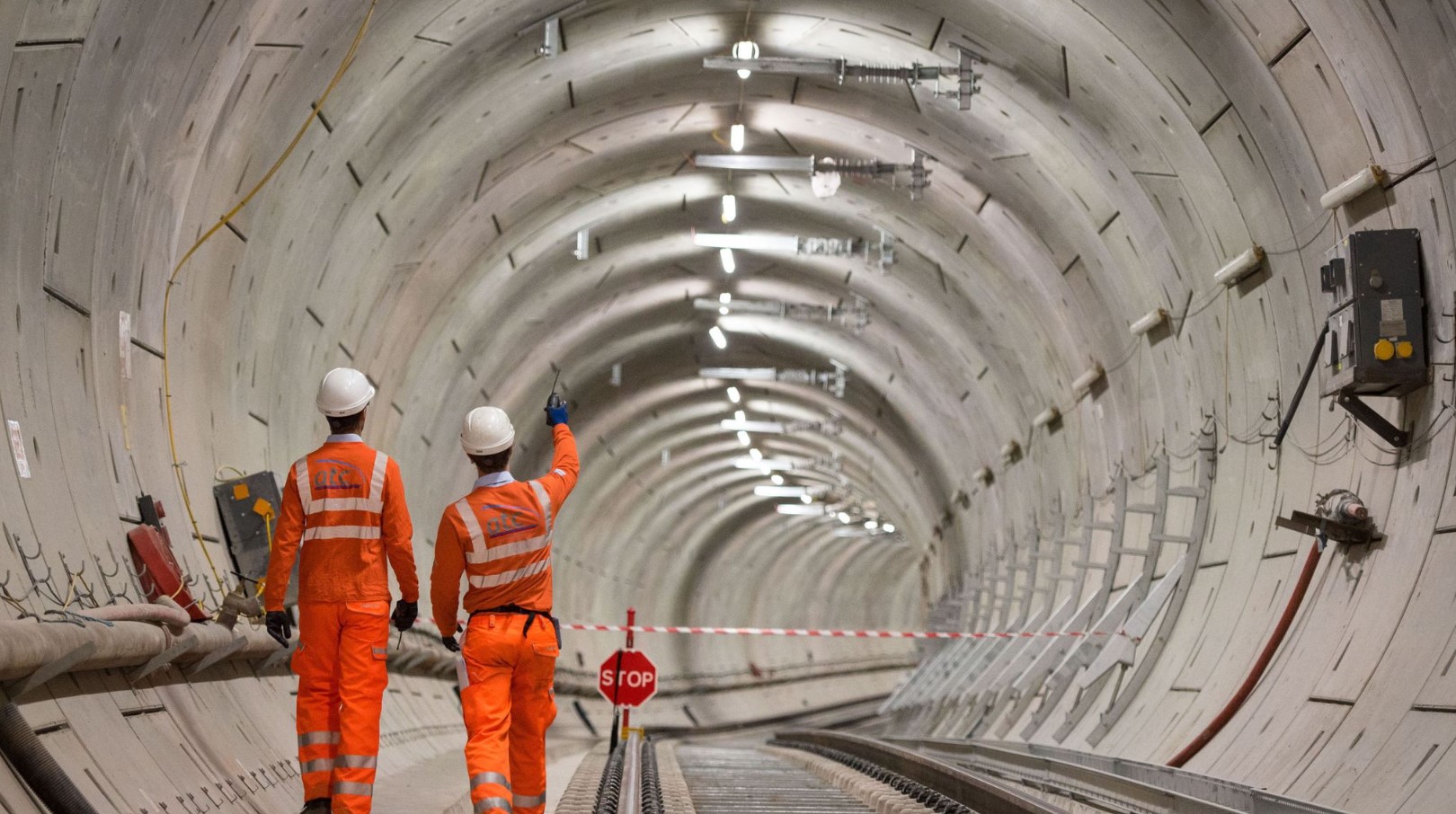
2. Improved Project Coordination
What It Is: BIM and GIS facilitate seamless collaboration among various disciplines involved in a project, integrating data from architects, engineers, and construction managers.
Why It Is Important: Effective coordination ensures that all team members are on the same page, reducing errors and rework, and promoting a smoother project workflow.
Applications:
- Synchronising design changes across all project stakeholders.
- Coordinating schedules and resources for efficient project execution.
- Enhancing communication between different teams through shared models and data.
Real-World Example: The Crossrail project in London, UK, integrated BIM to coordinate efforts between various engineering disciplines, including tunnelling, station construction, and track installation. This coordination was crucial in managing one of Europe’s largest infrastructure projects, ensuring all teams worked seamlessly together, reducing delays and cost overruns.
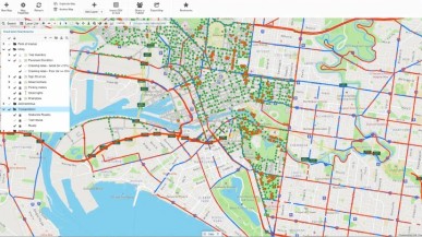
3. Better Data Management
What It Is: These technologies provide robust platforms for managing large datasets related to infrastructure projects, including spatial data, design parameters, and construction details.
Why It Is Important: Efficient data management ensures that accurate and up-to-date information is readily accessible, supporting informed decision-making and streamlined operations.
Applications:
- Integrating environmental impact data into project planning.
- Managing lifecycle data for infrastructure maintenance and upgrades.
- Using big data analytics for predictive maintenance and optimization.
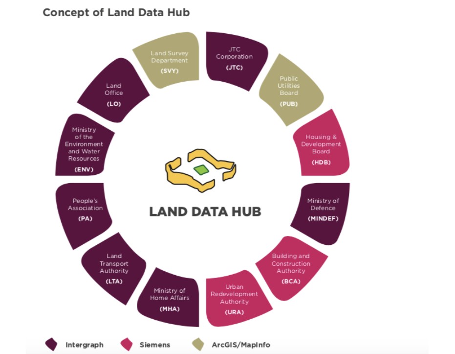
Real-World Example: The “Smart Nation Singapore” initiative leverages GIS to manage urban data, including transportation, utilities, and public services. By integrating spatial data with infrastructure information, city planners and engineers can make informed decisions, optimise resource allocation, and enhance urban living conditions for residents.

4. Increased Sustainability
What It Is: BIM and GIS enable the design and analysis of sustainable infrastructure solutions by incorporating environmental data and performance simulations.
Why It Is Important: Sustainability is crucial for minimising environmental impact, reducing energy consumption, and meeting regulatory requirements, ensuring long-term viability of projects.
Applications:
- Designing energy-efficient buildings and infrastructure.
- Conducting environmental impact assessments.
- Planning green spaces and sustainable urban developments.
Real-World Example: The Masdar City project in Abu Dhabi, UAE, uses BIM and GIS to design and monitor sustainable urban development. These technologies enable planners to incorporate renewable energy sources, optimise building orientations for natural cooling, and reduce carbon footprints, aiming to create one of the world’s most sustainable cities.
5. Cost Efficiency
What It Is: These technologies help identify potential cost savings through better planning, design, and management of construction processes.
Why It Is Important: Cost efficiency is a key driver in the construction industry, impacting the bottom line and the feasibility of projects.
Applications:
- Identifying and mitigating potential construction risks early.
- Optimising material usage and reducing waste.
- Streamlining construction schedules to avoid delays and associated costs.
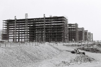
Real-World Example: The construction of the Louvre Abu Dhabi in the UAE used BIM to streamline design and construction processes. By simulating construction sequences and identifying potential issues beforehand, the project managed to stay within budget and avoid costly delays, demonstrating the financial benefits of advanced project planning.


6. Amplified Safety
What It Is: BIM and GIS support the analysis and mitigation of safety risks in construction projects, from design to execution.
Why It Is Important: Safety is paramount in construction, with significant implications for worker well-being, regulatory compliance, and project success.
Applications:
- Simulating construction site conditions to identify hazards.
- Planning emergency response strategies using spatial data.
- Monitoring construction progress to ensure adherence to safety standards.
Real-World Example: The reconstruction of the I-35W bridge in Minneapolis, USA, after its collapse in 2007, incorporated BIM to enhance safety during construction. Safety simulations and risk assessments were conducted to ensure the new bridge met rigorous safety standards, ultimately leading to a successful and secure completion.

7. Future-Proofing Your Career
What It Is: A master's degree in civil engineering with a focus on BIM and GIS equips you with cutting-edge skills and knowledge that are in high demand in the industry.
Why It Is Important: As technology continues to evolve, professionals with expertise in these areas will be well-positioned to lead and innovate in their field.
Applications:
- Leading digital transformation initiatives in construction firms.
- Developing smart cities and infrastructure projects.
- Pioneering new methods and technologies in civil engineering.
Embarking on a master’s degree in civil engineering with a specialisation in BIM and GIS not only enhances your technical prowess but also opens up a world of possibilities for innovation, efficiency, and sustainability in the construction industry. It’s an investment in your future, setting you apart as a leader in the field.
Real-World Example: Hossam Abdulaziz is Senior BIM Manager at SYSTRA Arabia and Alumni of our Master’s in Global BIM Management in Civil Engineering and GIS. He works with large scale projects like NEOM's Oxagon, a new floating city touted to be the "world's largest floating structure".
In this video he shares why he chose to enrol in ZIGUART's master's programme and what are the benefits of integrating BIM and GIS in infrastructure projects: